 IMAGIS also deals with distribution of GIS software manufactured by Pitney Bowes Software (former MapInfo). MapInfo Pro software for creating maps, mapping the data and their analysis is a flagship of Pitney Bowes. IMAGIS creates a Polish version of MapInfo Pro and offers other products from MapInfo family, among others, Vertical Mapper, Encom Discovery and MapInfo Manager.
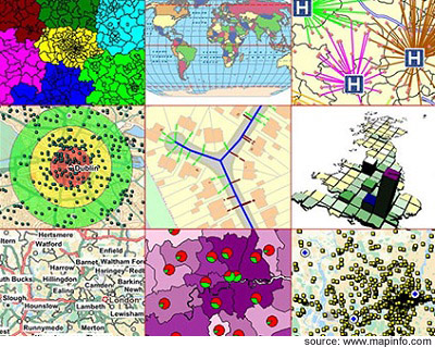 MapInfo ProTM (former MapInfo Professional)
MapInfo Pro is a powerful mapping and geographic analysis application. By visualising the relationships between data and geography, MapInfo Professional makes it fast and easy to create, share and use maps by turning data into information. More info ...
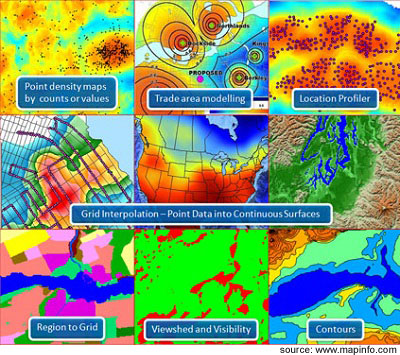 MapInfo Vertical Mapper
MapInfo Vertical Mapper is a spatial data analysis tool that lets you display, manage and interpret grid-based continuous spatial information. Gain an upper hand by turning geospatial data into compelling information and actionable insight. More info...
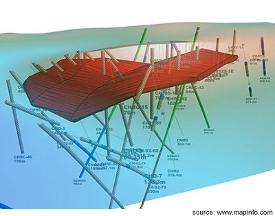 MapInfo Discover 3D
MapInfo Discover 3D has been the leading Geographical Information System (GIS) for the exploration and mining industry for close to 20 years. The package specializes in data collection, technical data management, geographical information analysis, integration, modelling and visualization.. More info...
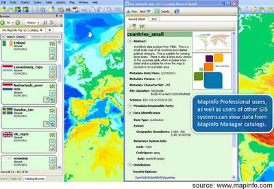 MapInfo Manager
MapInfo Manager enables you to build and manage a centralised library for all your spatial data assets. This searchable library acts as the authoritative single source of truth for your spatial data. Your data becomes easy to find, use, understand and share across your organisation. More info...